
Enterprise Tracking and Asset Management Solution for the Department of Defense
/CLIENT: Department of Defense’s United States Transportation Command (USTRANSCOM) and Military Surface Deployment and Distribution Command (SDDC)
LOCATION: United States
CHALLENGE
The Department of Defense’s United States Transportation Command (USTRANSCOM) and Military Surface Deployment and Distribution Command (SDDC) needed a better way to handle infrastructure and obtain real-time logistics data to manage, document, and synchronize movements worldwide.
SOLUTION
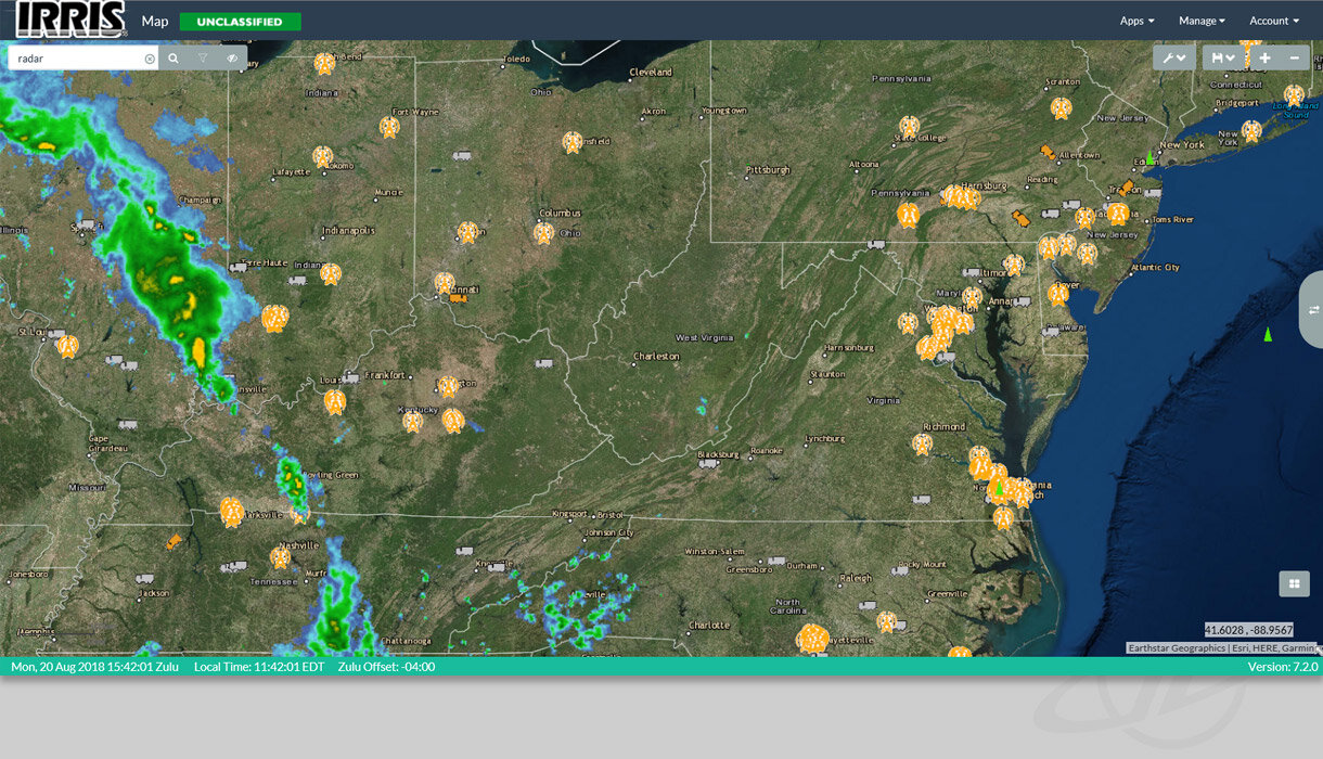
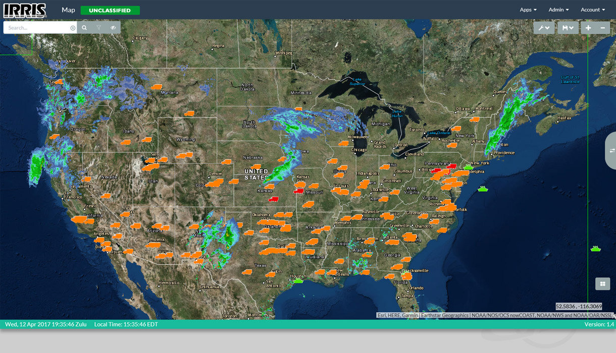
For more than 20 years, GeoDecisions partnered with USTRANSCOM and its subordinate command SDDC to develop and refine the Transportation Geospatial Information System (TGIS), an enterprise secure tracking and asset management solution. Built on the Esri ArcGIS® platform utilizing JavaScript API, TGIS incorporates more than 1,200 GIS layers with real-time monitoring of critical infrastructure and incident response capabilities into a single, secure application for the rapid deployment of assets, equipment, and personnel.
TGIS was developed as an open geospatial system to accommodate information from various databases and support the coordination of the logistics pipeline's visibility, management of the supply chain, and support of emergency management activities. This solution is responsible for tracking truck movements throughout the U.S., cargo ships around the world, and smaller mobile devices that can be placed in any moving vehicle to track missions worldwide. It is even responsible for tracking top secret documents and packages.
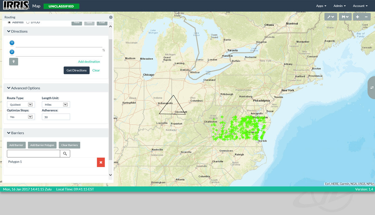
TGIS allows users to set permissions and share data while simultaneously visualizing data via maps, providing a common operational picture. Its mapping capabilities enable users to visualize spatial relationships via tailored maps, calculate distances between selected points, determine latitude/longitude coordinates, provide alerts if a driver deviates from a specified route, and display information via maps.
Using ArcGIS Server, Portal for ArcGIS, ArcGIS Desktop, and ArcGIS Pro, TGIS ingests, creates, converts, publishes, and sustains more than 1,200 data layers. Once published, the layers are offered to other systems or users for download in various formats, from KML to Shapefile, from GeoPDF to File GeoDB, and many others. All of this is deployed in a secure cloud environment and conforms to federal security practices.
KEY TECHNOLOGY
Esri ArcGIS Platform
Esri Portal for ArcGIS
Esri ArcGIS Desktop
Esri ArcGIS Pro
Java Script API
Oracle Database
.NET Framework
KEY RESULTS
A configurable web application creator allows users to create maps and applications for specific needs, resulting in a no-code way of creating new applications.
The solution reduces costs, increases collaboration, and mitigates risks.
Permissions can be assigned for select views.


