
Preparing the Way for Esri's ArcGIS Utility Network
/Client: Lehigh County Authority
Location: Wescosville, Pennsylvania
CHALLENGE
The Lehigh County Authority (LCA) needed to provide advanced, attribute-rich data to their constituents in real-time but could not do this without the proper utility asset management solution. As a public water and wastewater utility, asset management is essential because certain functions, such as tracing the paths of connected water pipes, rely on asset management. During an emergency, improper asset management could lead to a number of other issues, such as misidentifying affected customers, turning off the wrong valves, and interrupted service. To make the transition to a better asset management solution, LCA's team needed the right expertise to conduct data health checks, prepare the appropriate data, and assess their data's readiness.
SOLUTION
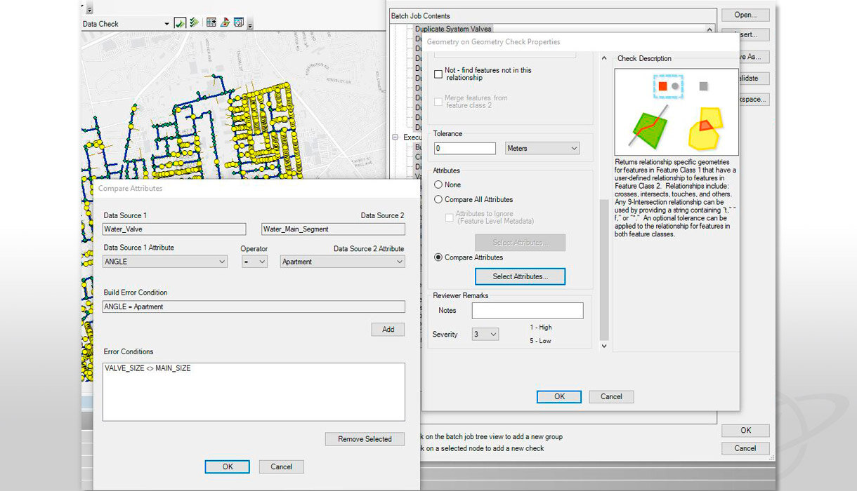
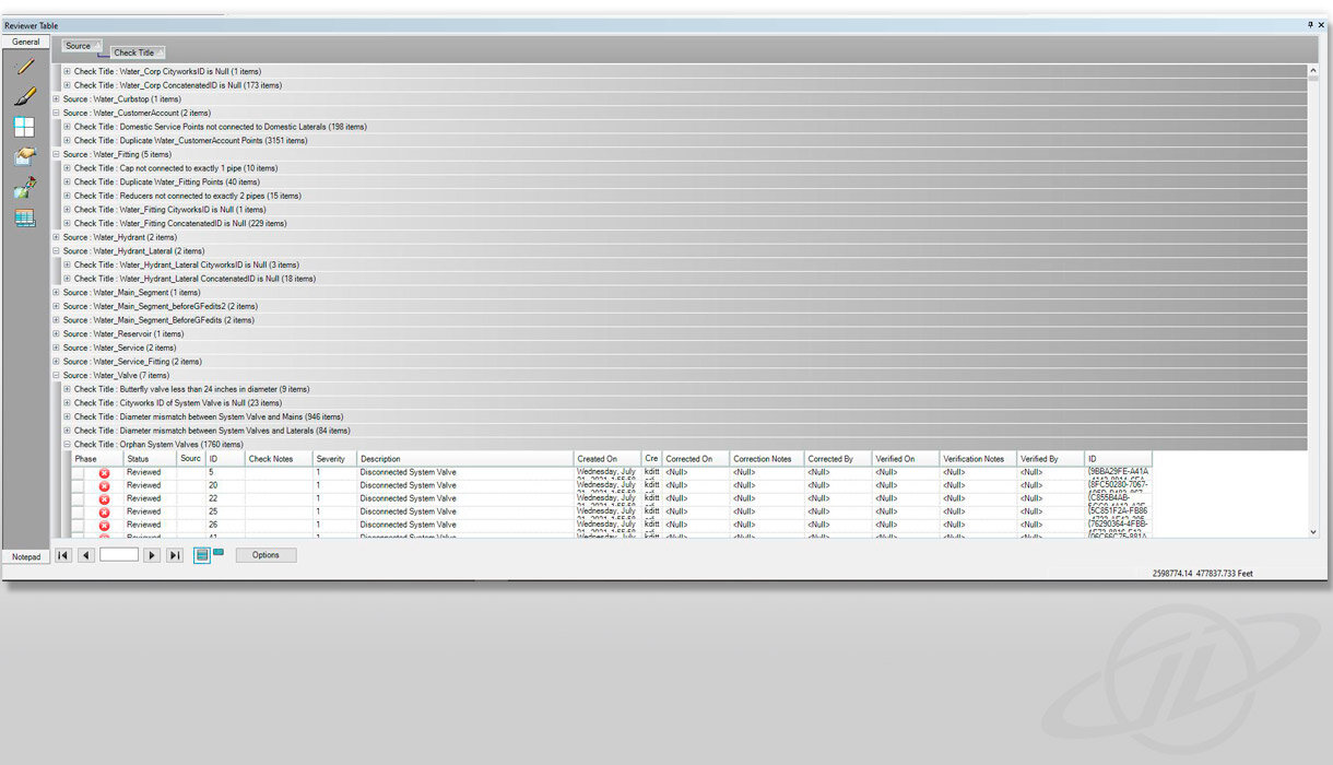
After evaluating LCA's challenge, GeoDecisions determined that a transition to Esri®'s ArcGIS Utility Network was needed to prepare them for the next generation of asset management solutions. Upon reviewing LCA's water and wastewater geographic information system (GIS), GeoDecisions identified LCA's topology, feature, and attribute integrity as needing preparation for the Utility Network. GeoDecisions' team ran ArcGIS Data Reviewer checks and primed LCA's IT infrastructure to run future edits and updates, which are important for maintaining the system's quality control through its lifetime. These initial steps are essential because process and procedure, definition, and refinement maximize quality assurance from the very beginning. GeoDecisions also prepared the data features' detail, logic, and connectivity to ensure the intelligence of the network. Once all data was assessed and updated, the Utility Network tools were used for condition assessment, modeling, asset management, and trace-flow.
To prepare LCA's data, GeoDecisions defined LCA's assets to set them up for success in an asset management program. In order to align pipe segments, GeoDecisions eliminated unnecessary short segments, vertices, and connectivity, such as crosses or overlaps. Furthermore, to guarantee the Utility Network's success, GeoDecisions determined critical attributes for all assets' size, type, install year, and operability. The completeness and connectivity of point and line features, including valves, fittings, and structures, were essential. Data checks on crosses and overlaps, fittings and valves, hydrants, pipe segments, blow offs, and topology were also required for this transition. By reviewing LCA's existing data and attributes, GeoDecisions' team ensured clean data for a smooth transition to Utility Network.
LCA now has the tools, resources, and data readiness needed to transition smoothly to Utility Network. This transition moves LCA to a services-based architecture, giving them the option to provide advanced, attribute-rich data to their constituents in real-time.
KEY TECHNOLOGY
Esri Data Reviewer Extension
Esri ArcGIS Utility Network
Data Readiness
Esri Portal for ArcGIS
Esri ArcGIS Server
Esri ArcMap / ArcGIS Pro
KEY RESULTS
Developed a more efficient quality assurance/quality control (QA/QC) system, allowing LCA to run effective data quality checks.
Trained LCA staff to know how to package checks to save time, money, and resources on QA/QC
Developed a data quality matrix to help the client determine the status of their data, identify null values, and find where records were unpopulated.


