Leveraging Technology and Geospatial Tools in 2023
/Ideas and innovations continue to push boundaries and disrupt business operations, compounded by post-pandemic factors and the fourth industrial revolution. Where is our world really headed regarding technology and geospatial tools?
While no one can predict the future with absolute certainty, analyzing industry trends provides insight.
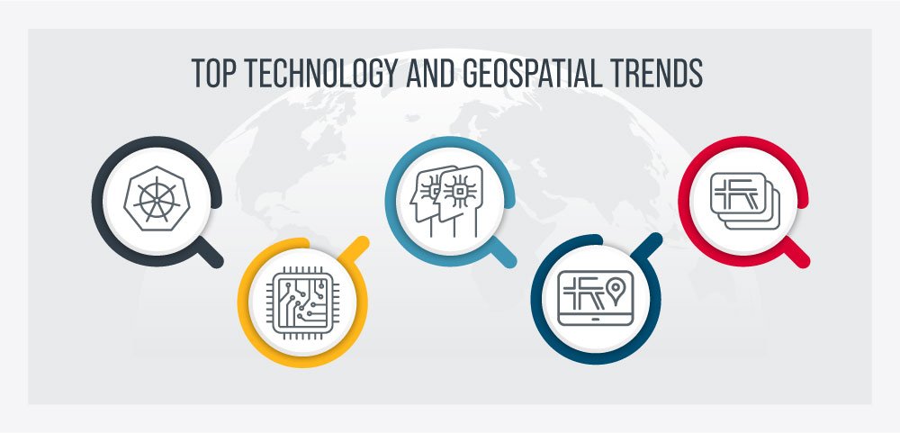
Together Andy Lovell, GISP, AEC solution engineering lead at Esri, discussed the top technology and geospatial trends impacting the architecture, engineering, and construction (AEC) industry:
Kubernetes.
Geospatial machine learning and artificial intelligence.
Digital twins.
GeoBIM.
High-definition (HD) maps and lidar.
See our complete conversation in this on-demand webinar; meanwhile I’ll call out a few key points in this blog.
The top technology trends include Kubernetes, AI/ML, digital twins, GeoBIM, HD maps, and lidar.
Increased Kubernetes Implementations
Increased Kubernetes deployments/implementations
- Enhancing organization scalability.
- Decreasing risk with investment in on-premise servers and IT equipment.
- Improving organizational efficiency with less downtime for system updates.
Companies are now considering Kubernetes for their cloud processing needs. Kubernetes is an open-source platform that orchestrates containers that allow for data and process workload balancing, automated program updates, and data management built in a scalable environment. It takes data availability to the next level and allows computing at a different scale. The most significant impact Kubernetes has on our industry is that it is a transformation agent.
Kubernetes Implementation Benefits
There are multiple benefits to Kubernetes – both from client and developer perspectives. The main client benefits include:
Scalability: Being able to respond to system demand is a significant benefit. Clients can scale up or down depending on their needs. Here is an additional resource regarding scalability.
Cloud environment: Decreased investment in on-site servers and the resources to keep them operating.
Return on investment (ROI): Having fewer resources tied up with on-site services allows clients to invest that money in other business-specific technologies and system improvements.
System upgrades: Clients can upgrade their various systems at a much higher rate due to the power of the cloud, increasing their overall efficiency.
Esri’s Kubernetes Implementation Strategy
Many people think Esri is incompatible with Kubernetes, but that is just a myth. ArcGIS Enterprise will perform on Kubernetes, as well as other cloud platforms. The two most significant benefits clients see are the ease and speed of software updates and the scalability Kubernetes creates for growing organizations.
Why Geospatial Artificial Intelligence/Machine Learning Will Become Mainstream
Increased geospatial AI/ML adoption and configuration in AEC
- Introducing geospatial context into technology.
- Improving accuracy of asset management through AI/ML applications.
- Expanding use of chatbots and other AI for content creation.
Everywhere we look, we see applications of artificial intelligence (AI) and new ways to implement machine learning (ML) to increase efficiency. The primary component that both technologies are lacking is geospatial data.
An example of how adding geospatial information improves the outcome is our recent project helping the Department of Veteran Affairs (VA) National Cemetery Administration (NCA) with their veteran cemetery records. We leveraged global positioning system (GPS) with ML to capture the precise locations and translate the information on each of the headstones in NCA’s 66 cemeteries nationwide. The AI/ML approach improved accuracy by 15% and decreased the time to process the collected information by 1,000%.
Use Cases for Geospatial AI/ML
Opportunities to implement AI/ML are growing by the day. Some AEC-specific use cases include:
Image classifications and extraction.
Turning images into text.
Spatial analysis.
Esri ArcGIS Knowledge
Esri ArcGIS Knowledge produces knowledge graphs that implement spatial analysis to uncover data patterns and accelerate decision-making. The result is the ability to identify patterns you normally wouldn’t be able to see.
One example of how Esri ArcGIS Knowledge can positively impact AI/ML is the ability to integrate weather information with a building information model (BIM). While you normally wouldn’t consider these two components together, adding geospatial information allows building maintenance professionals to determine system and physical asset maintenance needs based on weather trends.
Opportunities to Leverage Digital Twins in Horizontal Processes
Increased digital twin-based decision-making
- Increasing collaboration and teamwork throughout the entire procurement and project life cycle.
- Increasing sustainable project delivery through digital delivery and digital record keeping.
- Increasing efficiency and business process automation.
“Digital twins” means different things to different people. Commonly defined as a digital representation of either the future or present state of a physical world, we are adding a geographic information system (GIS) component for this discussion. Digital twins are another phenomenon transforming the AEC industry, allowing for improved decision-making and fiscal responsibility.
Digital Twin Benefits
Collaboration: Bringing the entire project life cycle and all disciplines into a common operating platform.
Centralized data: Storing all data (design, as-builts, operation manuals, etc.) in one central location. Anyone on the project team can access the current documents, increasing efficiency with access to real-time data.
Digital delivery: Eliminating hard copy production and delivery and allowing for real-time changes and updates, increasing accuracy.
Esri’s Perspective on Digital Twins
The AEC industry has a general misunderstanding of digital twins. Rather than thinking about a digital twin as an object or thing, think of it as a workflow. Digital twins create a fluid environment where you can introduce possibilities into the physical world and make processes more widely accessible. At the heart of it, digital twins allow for better decision-making and data accessibility.
How GIS and BIM Converge Into GeoBIM
Increased collaboration between GIS and BIM for authentic GeoBIM environments
- Increasing collaboration across disciplines for improved project delivery.
- Increasing project-related record accuracy through centralized data.
- Increasing integrations across software platforms through strategic relationships.
Historically, GIS and BIM have operated independently in the AEC marketplace. Converging the two technologies results in GeoBIM, and the industry is already benefitting. This convergence is also supporting digital twin adoption and implementation.
GeoBIM Benefits
The benefits are numerous, but the top benefits include:
Centralized data: A single source of data for all project-related information, allowing each discipline to see the whole picture and other disciplines’ perspectives.
Role-curated collaboration: Staff in different roles can work together on the project simultaneously and in tandem, decreasing conflicts and increasing efficiency. Having different project roles work in the same files allows for prompt feedback and quick action for any needed adjustments as the project progresses. Staff in engineering roles can lean into the engineering side of the project, while GIS roles are able to augment the data from their fieldwork or environment data.
Digital delivery: This approach creates balance for information sharing and collaboration throughout the project life cycle from initial idea conception through final project delivery. It decreases the time needed to transform the drawings and changes to provide insight and feed third-party systems. All project stakeholders and staff have access to the latest information at any given time to view, export, share, and comment.
Esri Creates Strategic Partnerships
It is a common misconception that Esri operates independently of other software solutions providers. Quite the contrary. They have a well-established and close relationship with Autodesk and are helping pave the way for GeoBIM in AEC, as evidenced by the joint product ArcGIS GeoBIM. This project incorporates different tools and applications for various roles, bringing the information together from the Autodesk and Esri platforms.
Appropriate Uses for HD Maps and Lidar
Increased reliance on creating HD maps and lidar
- Improving accuracy of maps and other geospatial reference points through data sharing.
- Spreading adoption of existing technology to better serve communities.
- Expanding understanding of how geospatial information positively impacts the project life cycle.
Maps drive exploration and how we think about the world. The more detail the map can provide, the more accurate coverage and data we have for navigating and making sound decisions. One example is supply chain management. Understanding how goods flow throughout the delivery process increases the efficiency and accuracy of the products’ location at any given point.
High-definition maps and lidar go hand-in-hand as they create high-resolution models incorporating geospatial elements. Survey technicians capture information in the field using GPS units. GIS professionals use this information to add detail to maps, increasing accuracy. Although lidar is not new, we are seeing a resurgence of its use in the AEC industry, not to mention our personal lives via autonomous vehicles, robotic vacuums in our homes, and autonomous food delivery.
Potential HD Maps and Lidar Uses in the AEC Market
Collecting, extracting, and analyzing data are critical components of project delivery. Leveraging HD mapping and lidar data collection technologies could allow for:
Roadway maintenance: As cars move along various roadways and highways, their sensors can collect and transmit data to transportation agencies. This data could include roadway conditions, pothole locations, and striping conditions. Instead of sending the limited human resources out to survey countless assets, this data can be transmitted in real-time, allowing agencies to create more efficient maintenance programs.
General planning and public safety: With additional funding from the Infrastructure Investment and Jobs Act (IIJA), agencies are prioritizing their infrastructure improvement projects. Information gathered through surveys and other lidar methods can allow designers to determine where to place ADA ramps, bike lanes, and right-of-way for sidewalks.
Improved culvert design: By fully leveraging car sensors, they can also capture rain and storm event data. This data translates into accurately sized culvert and stormwater retention ponds, increasing the accuracy of land purchases for development.
Quality assurance and control: Vehicles and other assets can use the sensor information to compare against the original design, decreasing the demand for limited human resources for inspection and increasing the response time by various agencies to correct anything within the built environment.
Simply put, the more information we can share, the better our scalability and accuracy throughout the life cycle.
Summary: Leveraging Technology in 2023
Technology and geospatial tools influence the AEC environment daily. As we head into 2023, organizations should consider how they impact our business operations.
Increased Kubernetes deployments/implementations.
Geospatial machine learning and artificial intelligence becoming mainstream.
Opportunities to leverage digital twins in horizontal processes.
GIS and BIM converging into GeoBIM.
Appropriate uses for HD maps and lidar.
Be sure to watch the on-demand webinar for additional information on these top technology trends.
About the Author
Ohan Oumoudian
Principal, GIS/Geospatial Solutions
Email Ohan
Connect on LinkedIn


