
Modernizing Workflows for the Florida Department of Transportation District 6
/Client: Florida Department of Transportation
Location: Miami-Dade and Monroe Counties, Fla.
Challenge
The Florida Department of Transportation (FDOT) District 6 needed to improve operations, increase stakeholder service, and streamline business workflows. It used information technology (IT) and geographic information systems (GIS) services to establish better districtwide processes. To increase efficiency, reporting, and data collection safety, the district contracted Gannett Fleming doing business as GeoDecisions. As a part of our ongoing relationship, GeoDecisions completed a series of projects, many of which focused on improving workflows, managing data, and developing GIS applications.
Solution
Leveraging our long-term relationship with FDOT and Gannett Fleming’s experience providing a range of high-quality engineering services throughout District 6 and South Florida, GeoDecisions supported the district's Transportation Development Offices of Design, Program Management, Right of-Way Administration, and Planning and Environmental Management, delivering work via a general engineering consultant (GEC) contract. Our services included supplemental support through a staff augmentation model, including the Modal Development and Transportation Operations (Maintenance, Construction, and Traffic Operations).
GeoDecisions provided staff augmentation services, functioning as an extension of the district’s staff, by providing qualified team members assigned through individual task work orders (TWOs) on an as-needed basis. Assignments varied in scope and duration, and we often delivered multiple, simultaneous TWOs. In addition to the projects described, project requirements and scopes of work included establishing a single-source permitting coordinate system, creating reports, developing web apps, and supporting survey and GIS data model development.
Workflow Modernization
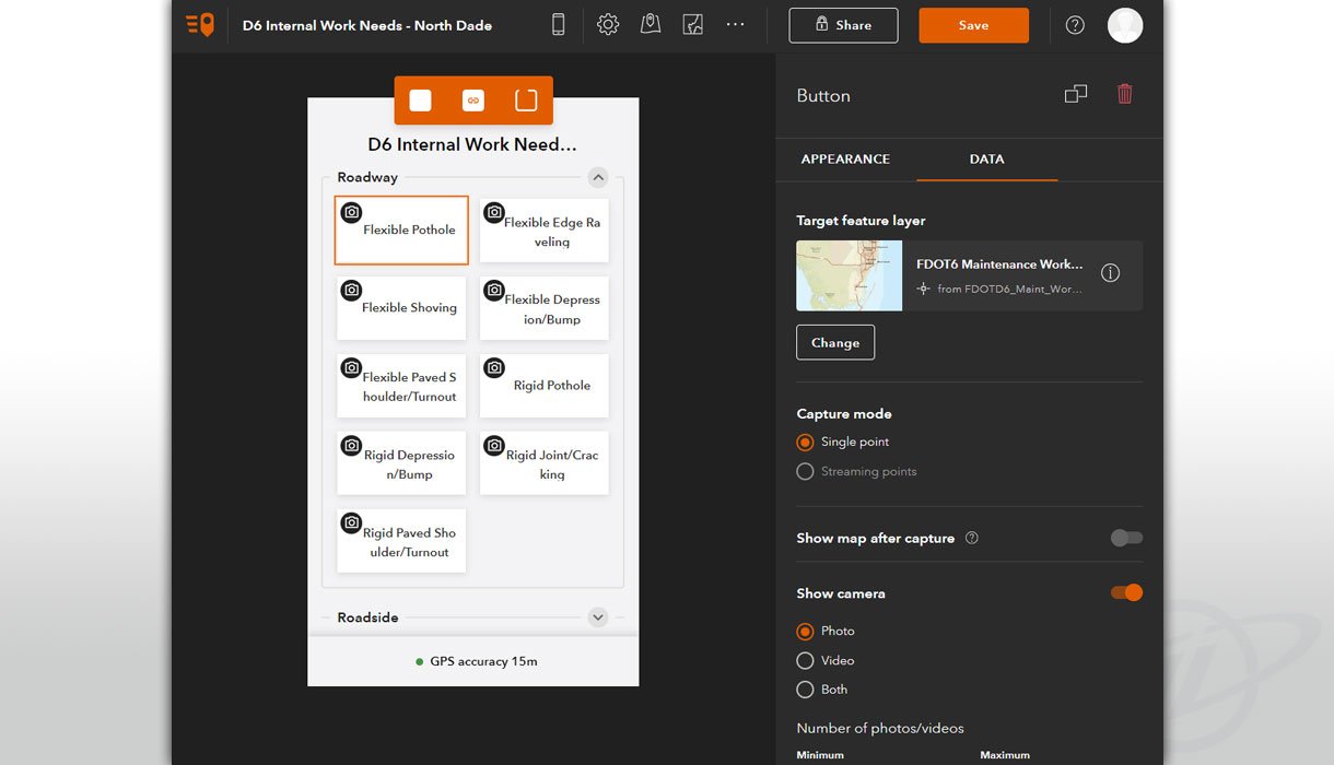
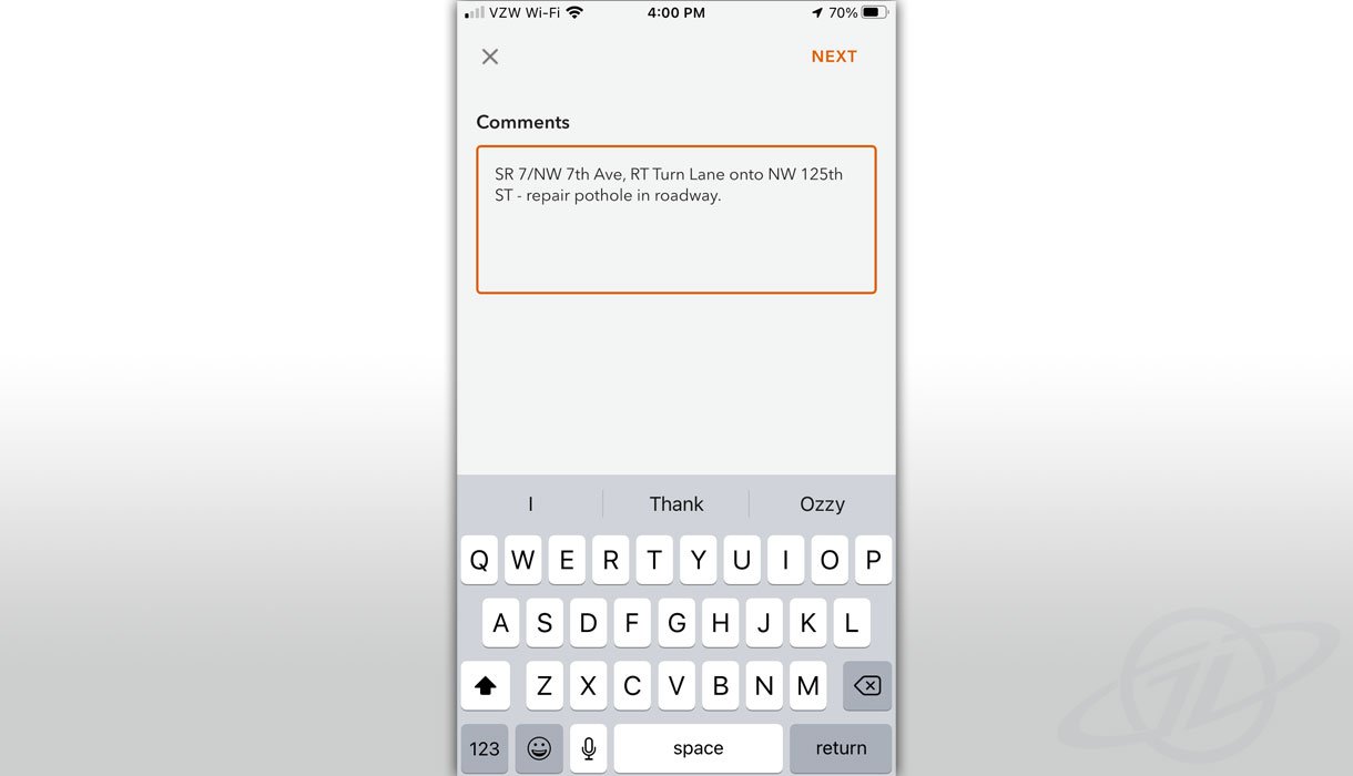
One TWO involved modernizing District workflows for the Maintenance Office. Throughout the development process, GeoDecisions was responsible for gathering requirements, evaluating data structures options integration, modernizing workflows, and incorporating GIS data into the workflows. Leveraging our platinum partnership with Esri®, we used ArcGIS QuickCapture and ArcGIS Dashboards to build a solution to display maintenance-related data.
Currently, the Maintenance Office uses the solution to evaluate data points collected in the field by inspectors. However, we included future functionality that will allow residents to submit maintenance requests using ArcGIS Survey123.
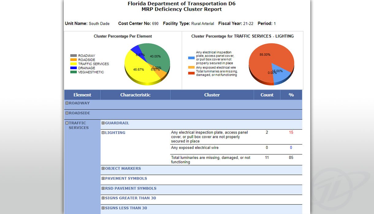
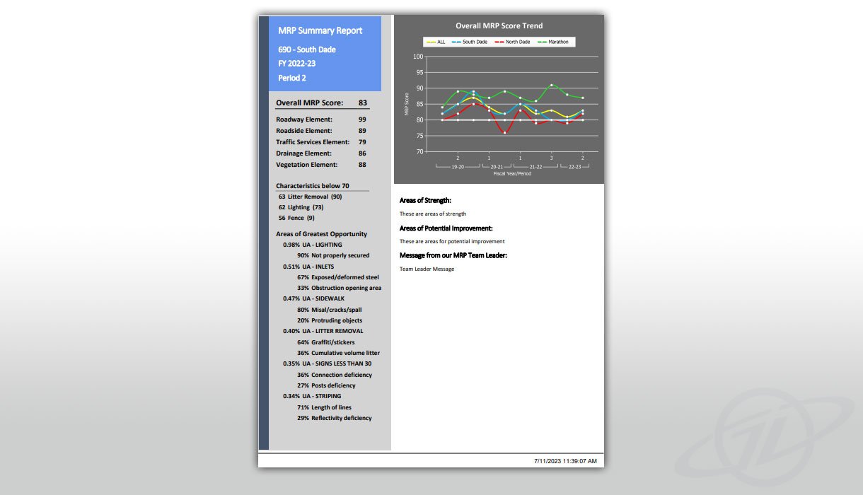
Maintenance Rating Program
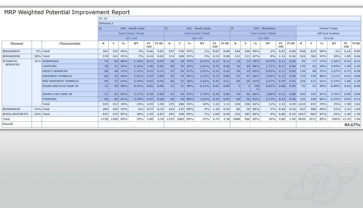
Every state is required to participate in a maintenance rating program (MRP) to evaluate its highway maintenance conditions. FDOT conducts visual and mechanical evaluations as a part of routine highway maintenance. Using the FDOT Central Maintenance Office report as a guide, GeoDecisions added GIS components to the facility type classifications, including elements and characteristics represented geographically. The tool provides multiple reports based on the GIS data, including GIS maps, summaries, deficiency clusters, and weighted potential improvements. Maintenance staff can better prioritize and schedule resources for routine, emergency, and maintenance activities.
Bridge Inspections
FDOT District 6 needed to improve its bridge inspection process. GeoDecisions is currently tracking multiple types of data collected from various District systems, including AASHTOWare™ Bridge Management (BrM). With access to real-time data, we will create a database with automated workflows to help the District better understand when bridges need inspection. This will allow the District to make more informed decisions about inspection timing, increasing its in-house teams' resource allocation efficiency.
Adopt-A-Highway Program
The Adopt-A-Highway (AAH) program administrators wanted an all-inclusive process for collecting, managing, and storing AAH volunteer groups, roadway adoption status, and group clean-up data. We identified and implemented opportunities to simplify and automate the various AAH procedures, including volunteer group registration, adoptable roadway assignments, pre-cleanup requests, and notifications to FDOT AAH project managers and representatives.
Key Technologies
Esri ArcGIS Dashboards
Esri ArcGIS Online
Esri ArcGIS QuickCapture
Esri ArcGIS Survey123
AASHTOWare™ Bridge Management (BrM)
Key Take-Aways
Workflow improvement: improved operations, enhanced stakeholder service, and streamlined workflows.
GIS integration: leveraged geographic data to create modern workflows and data reporting systems.
Process improvement: increased resource efficiency with data collection, system integration, and workflow automation.
Flexible support: provided staff augmentation services with high-level skill sets to serve the District with cost-effective IT and GIS solutions.


